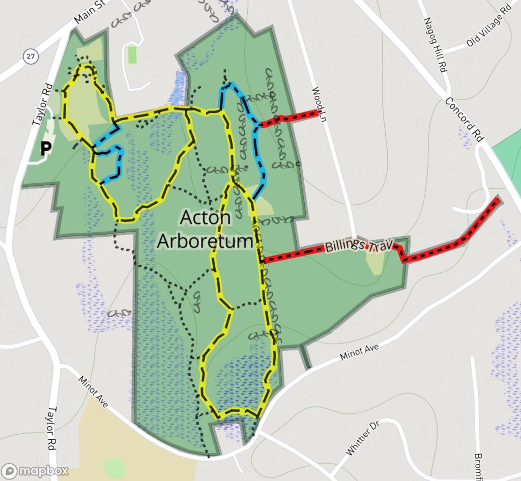
Friends of the Acton Arboretum Map
Location: Acton Center, on the east side of Main Street (Route 27), south of Town Hall
Loop trail: 1.5 miles
Acreage: 65
Terrain/Trail Conditions: Wide, smooth trails in Orchard Loop and Wildflower Loop made of crushed stone or paved asphalt; narrower woods trails along Highland/Bog Loop with some roots and rocks; wet areas spanned by boardwalks; minor changes in elevation throughout.
Entrances:
- East side of Taylor Road, south of its intersection with Main Street (Parking, Kiosk). Paved parking lot with 2 ADA parking spots Google Map Directions to Entrance
- End of Wood Lane, off Concord Road at Congregational Church (P, K). Parking along side of road at dead end.
- West side of Concord Road, between Minot Avenue and Concord Place (no parking)
- North side of Minot Avenue, at Forest Road (no parking). ADA sidewalk ramp completed in the summer of 2016. Bog boardwalk ADA but not trails.
The Acton Arboretum features 20 acres of lawn, tended gardens, ornamental trees and shrubs. The “back 40” of its acreage consists of woods, meadows, old apple orchards, a glacial esker, wetlands, two ponds, and a bog. Much of the area adjacent to Taylor Road is open and handicapped accessible, with gentle grades, a mix of paved and stone dust paths, benches, and picnic tables. The Arboretum’s trails are blazed in the wooded areas but are unblazed in open areas.
The land, successively owned by the Reeds, Tuttles, Craigins, and Bridges, was acquired by the town in 1976–77 and formalized as an arboretum in 1986. Since then, it has been developed by the Friends of the Acton Arboretum, Inc., assisted by the Acton Garden Club, Boy and Girl Scouts, local students, many volunteers, and town staff. Landscaping firms, local businesses and volunteers have donated services and materials.
The Friends of the Acton Arboretum maintains a website about the Arboretum at http://actonarboretum.org
The Arboretum has four access trails. One, a paved sidewalk, runs parallel to Taylor Road and connects the parking lot via the sidewalk to the Town Center green. A hosta garden, with numerous marked cultivars, lies along this trail together with a swale garden, a daylily collection, crab apple trees, and native shrubs. Three other access trails, from Wood Lane, Concord Road, and Minot Avenue, lead to different parts of the Highland/Bog Loop.
Three major loop trails along with interconnecting paths allow enjoyment of the property’s diverse areas. The two loop trails closest to the Taylor Road entrance, the Orchard Loop and the Wildflower Loop, share a common inner trail. Both are handicapped accessible. Please click on this link for a detailed handicapped inventory:
Beginning at the Taylor Road entrance, the Orchard Loop forms a circuit of the northwesterly, most open, portion of the Arboretum. Also located in this area are a small man-made pond and the remnants of an old apple orchard replanted with young trees. An old grape arbor has been renovated and its gardens planted with trees and shrubs suited for wetlands and providing food for birds. The trail has gentle grades, a crushed stone base, and benches along its length. Picnic tables and a stone reading circle add to the area’s usefulness. In the northern portion of this loop, situated around the old Craigin house foundation, is a typical 1700s herb garden, with medicinal, culinary, and strewing herbs. An old granite horse-watering trough, dated 1878, has been placed near the foundation. Also nearby are a butterfly garden and an arched arbor.
The Wildflower Loop, southeast of the Orchard Loop, traverses both swampy lowlands and upland woodland and incorporates two, 150′-200′ long, wooden boardwalks. The trail passes through an extensive woodland wildflower garden, a fern collection, two small farm ponds and crosses “Marys Brook.” In summertime, one of the ponds is solid green with duckweed and alive with frogs and turtles. Between the orchard/upper lawn area and the twin ponds is a teardrop-shaped trail called the “fragrance loop.” It is bordered by a lilac collection on the upper side of a stone wall, and a curved bench below. All of the fragrance loop plantings are scented, from hyacinth and peony, to lavender and azalea. On the westerly side of the Wildflower Loop, a small inner loop features a rhododendron collection, an American beech, a Japanese larch, a bald cypress, and two dawn redwoods.
From the northeasterly corner of the Wildflower Loop, a yellow-blazed connector trail leads to the Highland/Bog Loop, which is frequently rocky with raised tree roots and is not handicapped accessible. It covers the Arboretum’s southeasterly portion and traverses 30 acres of its highest and lowest land. Following old farm roads, cow paths, and foot trails, it comprises a variety of forest types, succession growth, and geological features. Inconspicuously scattered by the trailside are the “Forest Stones,” a collection of 22 field stones each inscribed with a single word, retained by popular demand after the 1995 Environmental Sculpture Exhibit.
Along its southwestern portion, this trail follows the top of an esker, a long, narrow, raised gravel ridge left by a receding glacier. The dry glacial gravel supports only pitch pines and oaks. The esker constitutes a drainage divide between the wetlands on the west that flows southward and the bog on the south that flows eastward. From the esker, the trail crosses a quaking bog, with its unique plant community, along a new boardwalk (with viewing platform and bench); and then turns northerly to eventually rejoin the Wildflower Loop via the connector trail.
In 2002, an 11-acre parcel (the “Donald swamp”) adjacent to the Arboretum’s southwesterly corner was donated to the town. Encompassing a red maple swamp and some wooded upland, it has an unblazed trail passing through it from the Highland/Bog Loop’s esker to the Wildflower Loop.
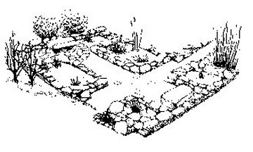
Craigin Foundation 19th Century Herb Garden
Drawing by Heather McElroy
Acton Arboretum Map as PDF