What is the Trail Through Time?
The Trail Through Time (TTT) is a 2-mile bi-cultural heritage trail. Forming a loop around one mile of the Nashoba Brook, the TTT passes through or accesses twelve sites where stone remains of structures from three periods of the land’s history still endure.
Walking in either direction around the loop, the visitor may be surprised by pre-historic, colonial, and industrial era stone ruins, all within a localized area.
While winding through diverse landscapes, the Trail crosses the brook twice on rustic footbridges. The walking is easy along most of the Trail as it meanders beside busy wetlands, through shady woodlands, and picks its way over a rocky section of an ancient Indian trail.
Location
The Trail Through Time lies mostly within the bounds of this Nashoba Brook Conservation Land. A Kiosk stands at the main entrance for the TTT, although two additional entrances, one with parking at Davis Road, and the other from Milldam Road in the Northbriar sub-division, also provide access.
Chosen as the Hub for the Trail Through Time, this location preserves remains of both the Thomas Wheeler, Jr., farmstead and cattle pens, and his 1730s grist and saw mills. Building these mills seems to have been the purpose for this North Acton settlement, originally known as Concord Village, that arose here.
PARKING INFO: On-Street Wheeler Lane Parking Prohibited
Alternative Trail Access Parking
- 21-29 Milldam Road (odd side Street only)
- DAVIS ROAD – unpaved lot (see Google maps)
- 9 CARLISLE ROAD – unpaved lot
- NARA Park – 25 Ledge Rock Way paved lot
VIDEOS
- Trail Through Time Video Tour, March 2021
- Native American Ceremonial Stone Structures of Acton, by Linda McElroy and Rob Houghton, October 21, 2021
Below are 2 maps of the Trail Through Time. Click on either to open a larger copy.
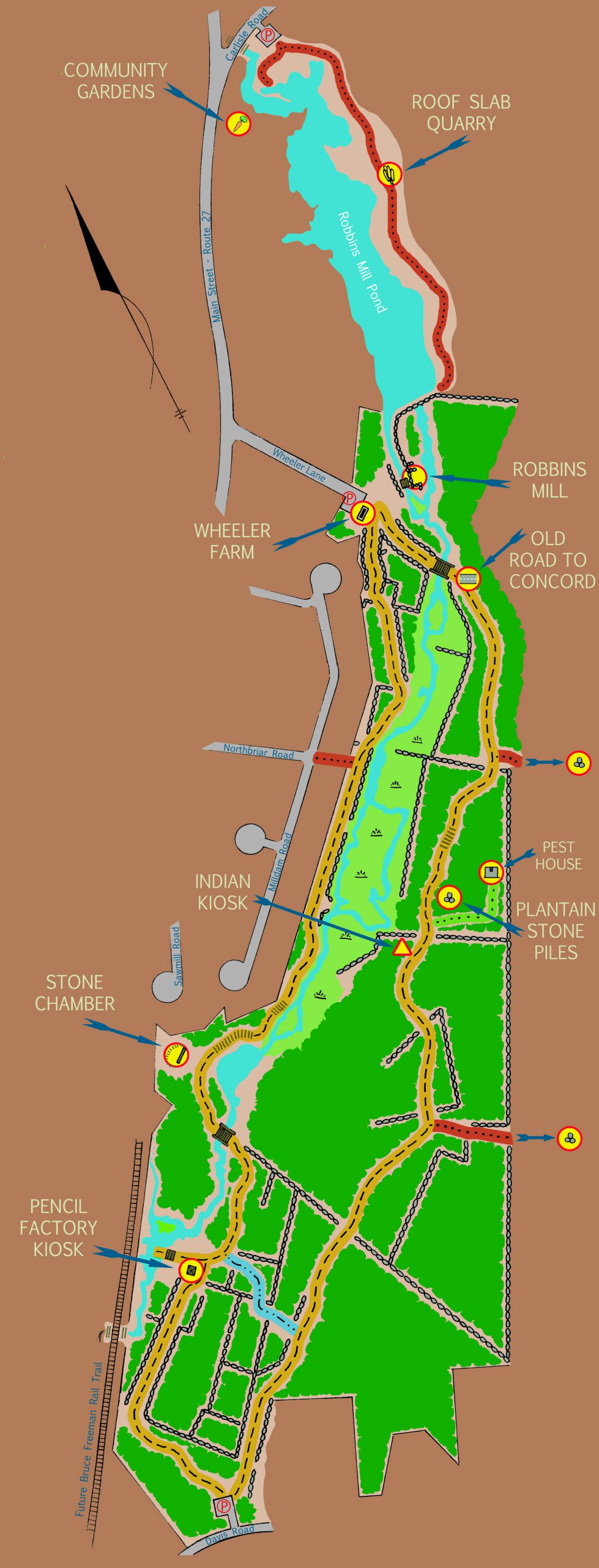
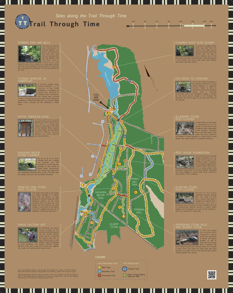
Stops on the Trail Through Time:
- Trail Through Time Trailhead Kiosk
- Wheeler Homestead
- Old Road to Concord
- Roof Slab Quarry
- Blueberry
- Plaintain Stone Piles Cluster / Pest House Foundation
- Native American Kiosk
- Princess Pine Stone Piles Cluster
- Pipsissewa
- Pencil Factory Site
- Stone Chamber